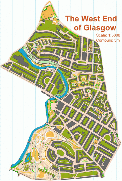
Glasgow, West End map
Information
Covering the area of Glasgow between Charing Cross and Maryhill, this urban map currently includes the east side of Kelvingrove Park as well as residential streets of varying complexity. The map is a work in progress, and is being extended to include Hillhead and the Glasgow University campus. Used for the Glasgow City Race in 2007 and club training events.
Location
Near: Glasgow G4 Lat,Lng: 55.87430,-4.27975 OS Grid Ref: NS576666 Postcode: G4 9HG What3Words: ///gosh.dunes.manliness
/-4.27975,55.87430,12/500x400?access_token=pk.eyJ1IjoicGF1bGZyb3N0IiwiYSI6ImNrb3dtYXoycjA2NGMyeHQ2bmRqMnFrZjIifQ.nP5lTcgIDEirGf32roluZg)
Open an interactive map in:
GoogleMap -
OpenStreetMap -
BingMap (OS 50k)

