
Mugdock Country ParkAnytime Orienteering
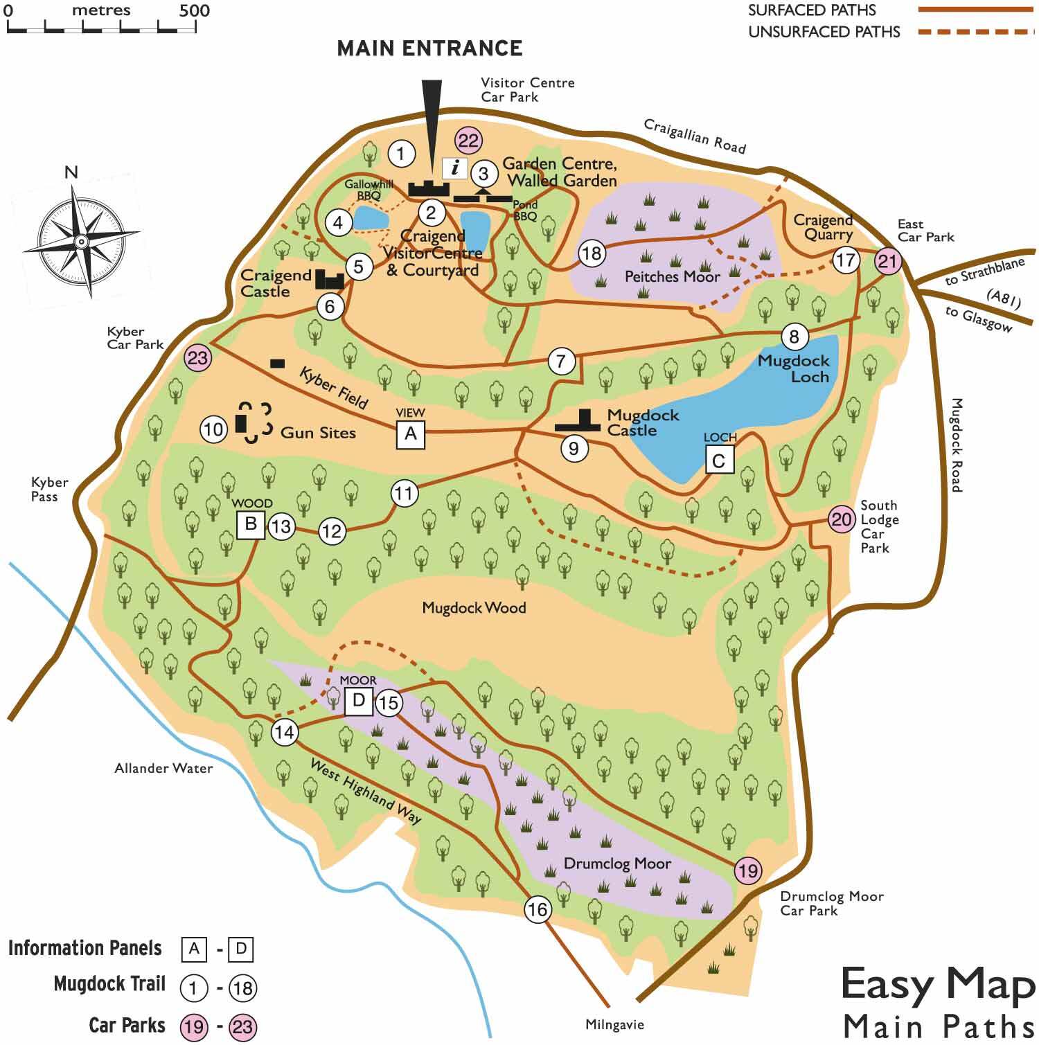
Mugdock country park map
Type of course: Permanent Terrain type: Parkland
Overview
Mugdock Country Park comprises of 270 hectares of woodland, moorland and heathland and is connected by a network of paths. 2 courses available.
Location Info
/-4.3297,55.9728,12/500x400?access_token=pk.eyJ1IjoicGF1bGZyb3N0IiwiYSI6ImNrb3dtYXoycjA2NGMyeHQ2bmRqMnFrZjIifQ.nP5lTcgIDEirGf32roluZg)
Near: Milngavie Lat,Lng: 55.9728,-4.3297 Postcode: G62 8EL What3Words: ///loans.outsmart.trader
Open an interactive map in:
GoogleMap -
OpenStreetMap -
BingMap (OS 50k)
Directions / Parking
The main car park is next to the Visitor Centre, toilets, cafes, shops and play park.
Courses available
Mugdock permanentScore course, Various, controls
Other Information
Visit the Mugdock Country Park website for details of other trails and activities.
Map packs £1 from the Park Office and Stables Gift Shop Park Visitor Centre Craigallian Road Milngavie www.mugdock-country-park.org.uk/orienteering 0141 956 6100
- White and/or yellow standard controls suitable for beginners
- Orange and/or light green standard controls suitable for people with some experience
- Green colour standard or above controls available for experienced orienteers
Safety Notes
You are responsible for your own safety – this has NOT been registered as an event with British Orienteering and is not covered by their liability insurance.
Nearest A&E Hospital
Queen Elizabeth University Hospital, Glasgow G51 4TFDog restrictions
Well-behaved dogs on a lead.