
Auchengillan
nr. Blanefield
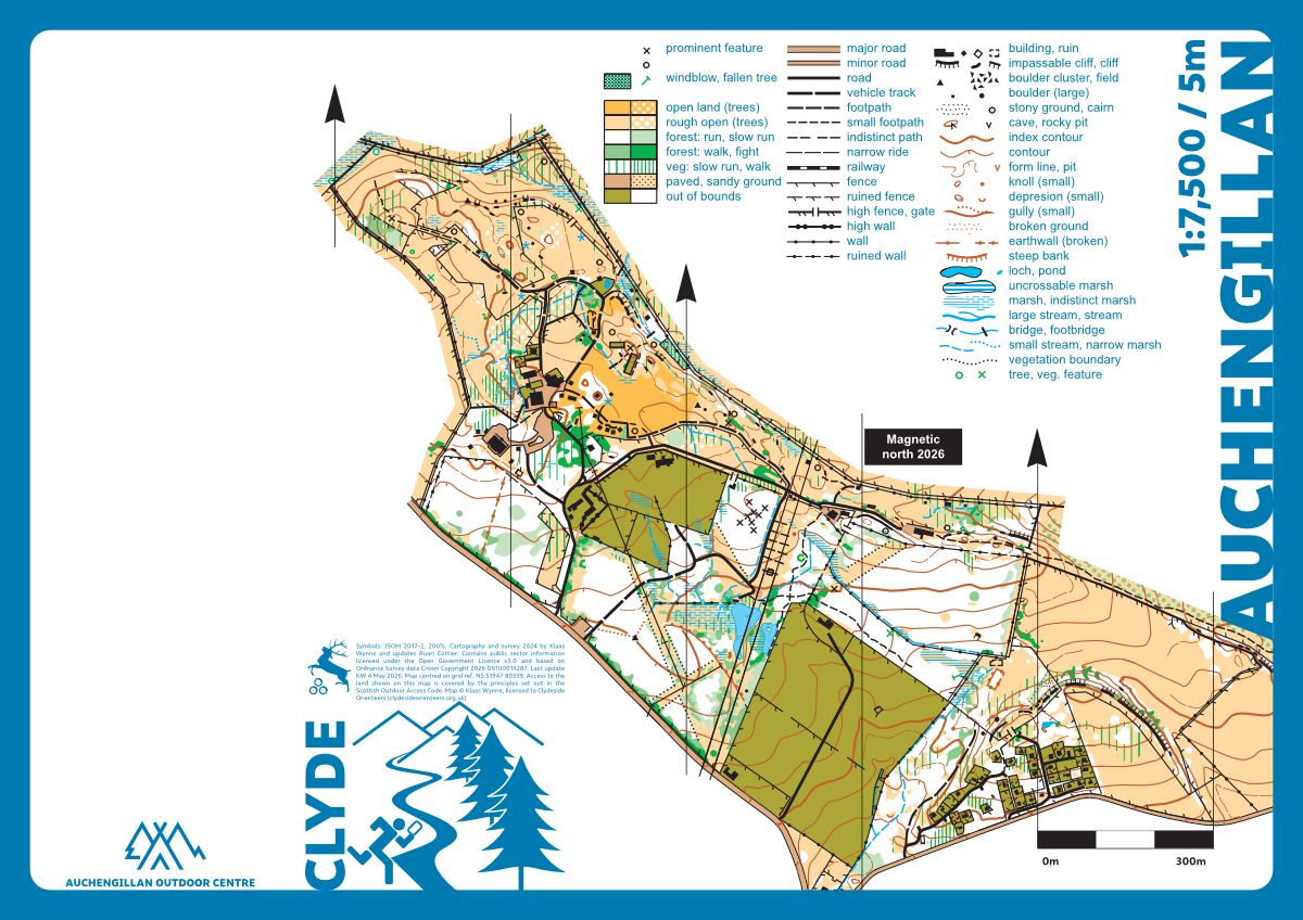
Auchengillan International Outdoor Centre is owned and operated by the Greater Glasgow Scout…
Balloch Country Park
nr. Balloch
Balloch Country Park is on the southeastern shores of Loch Lomond and easily accessible by car and…
Balmaha
nr. Balmaha

The map extends from the shores of Loch Lomond to the top of Conic Hill. Most of the area is open…
Barshaw Park
nr. Paisley
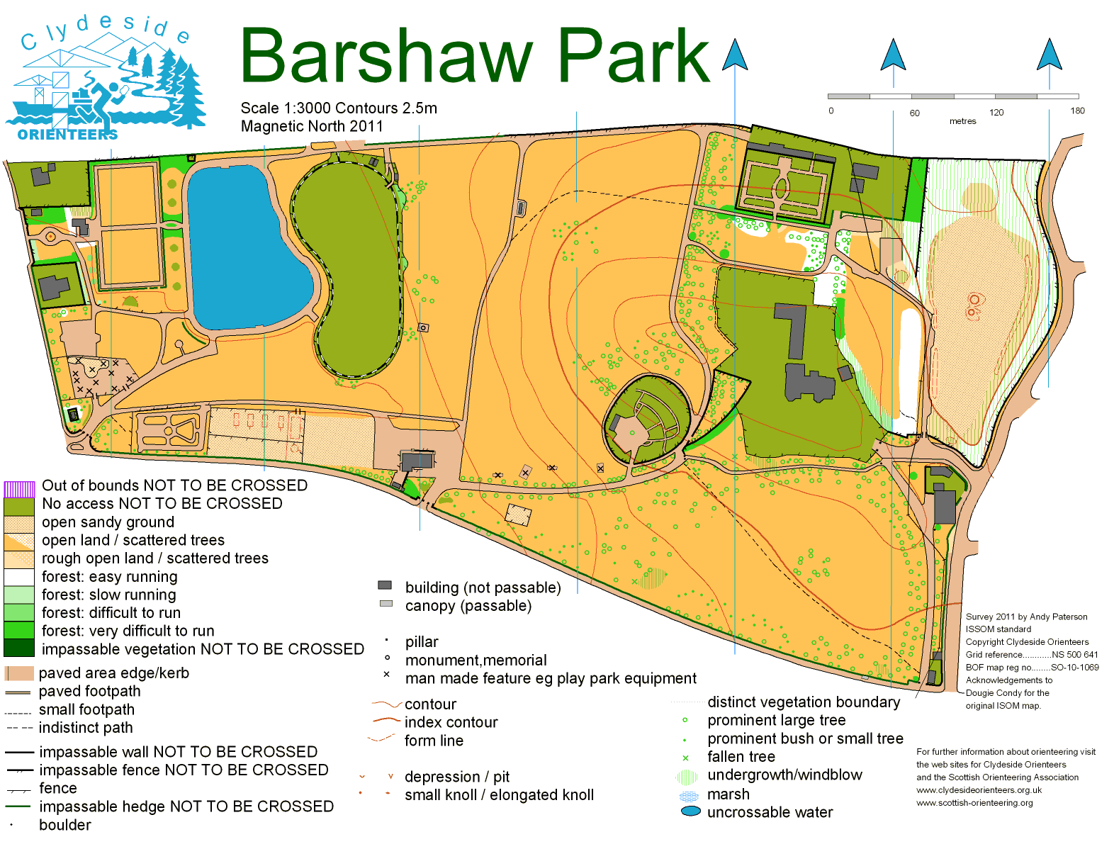
A well kept park in Paisley. Ideal for sprints races and short training sessions. There is even a…

Coille Nathais
nr. Taynuilt
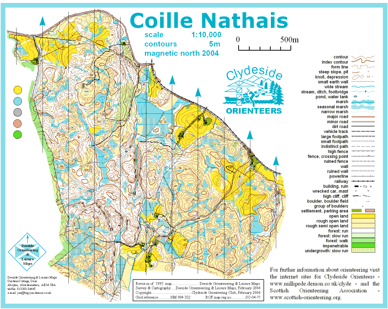
Classic Scottish West Coast Area. An area consisting mainly of natural woodland with some open…
Croy Hill
nr. Kilsyth
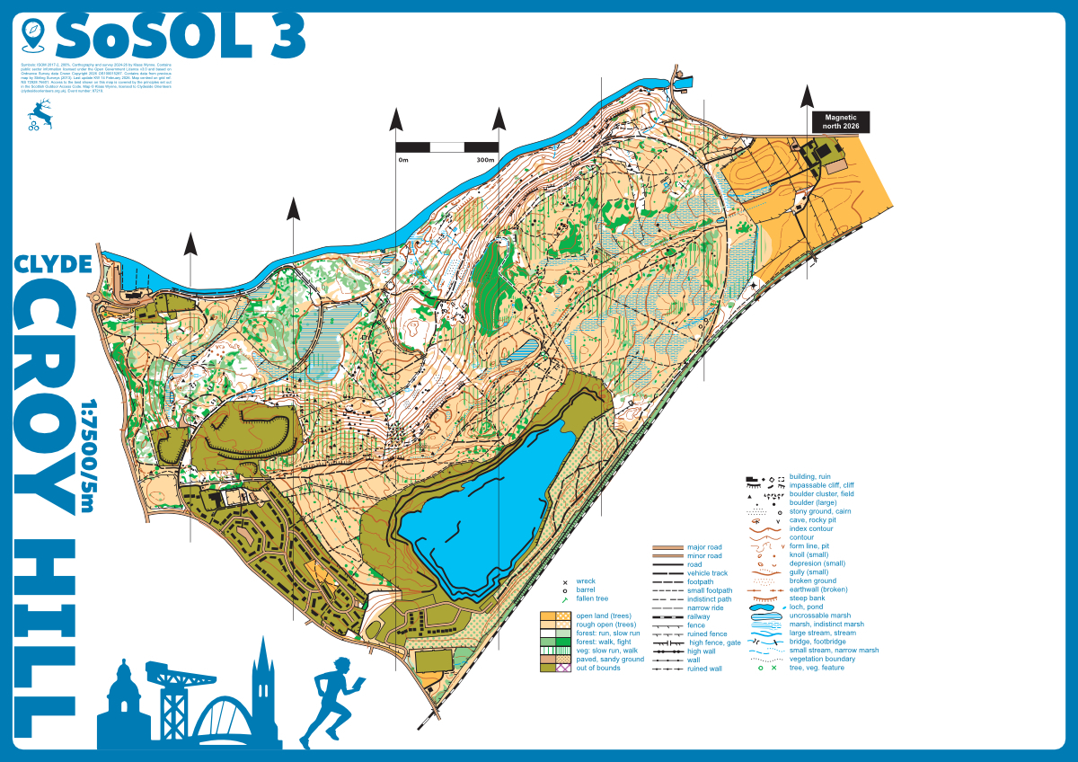
Croy Hill is situated near Kilsyth and is easily accessible by car (parking at Auchinstarry Marina)…
Dalry Moor
nr. Fairlie
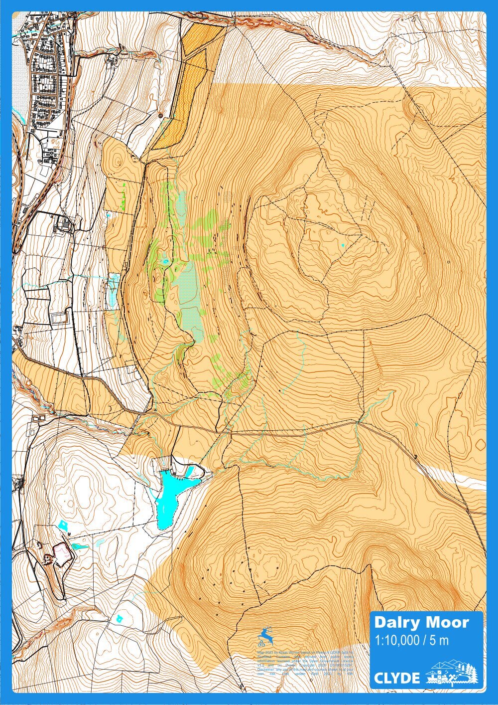
Dalry Moor (or Fairlie Moor) has not been used since the 1980s and is ideal for hill orienteering…
Dams to Darnley
nr. Glasgow
Dams to Darnley Country Park in East Renfrewshire south of Glasgow is one of the newest country…
Doon Hill and Fairy Knowe
nr. Aberfoyle
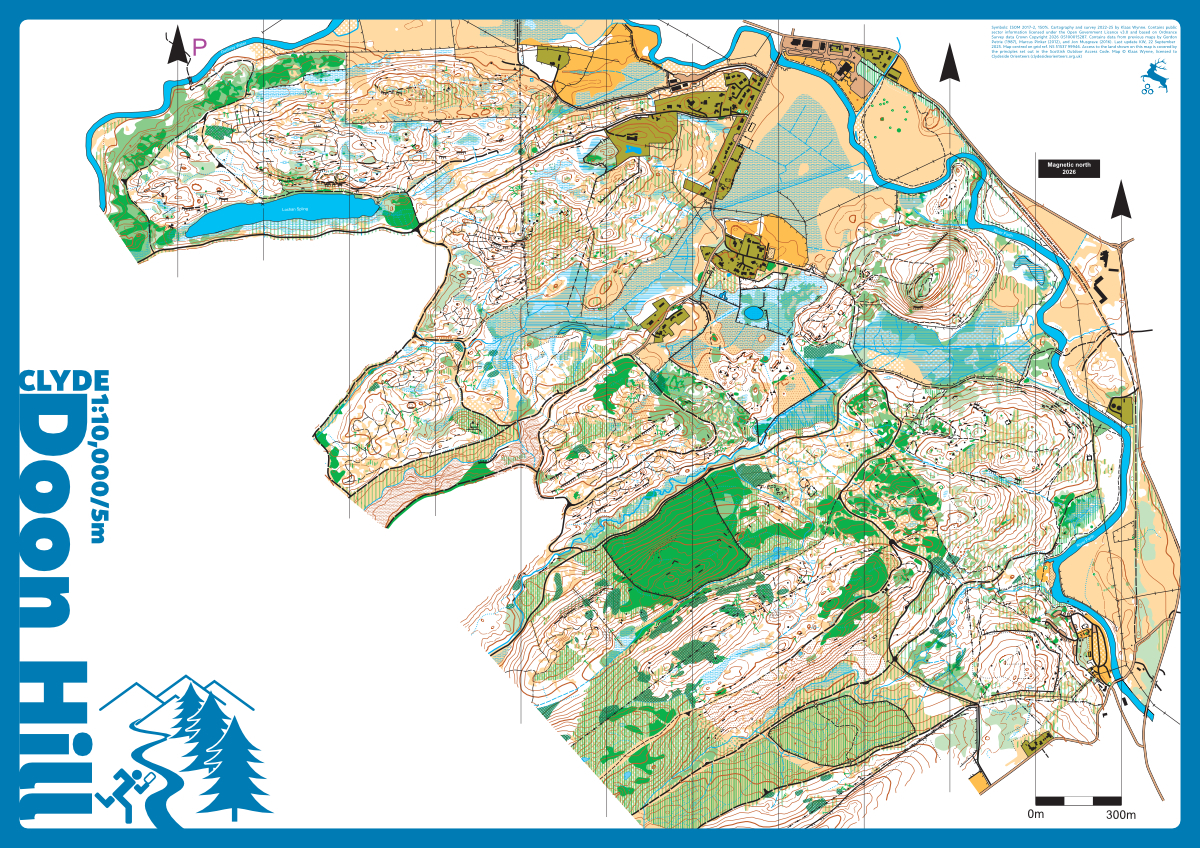
This area to the southwest of Aberfoyle has pretty much everything. Lots of good contour and rock…
Dougalston
nr. Glasgow
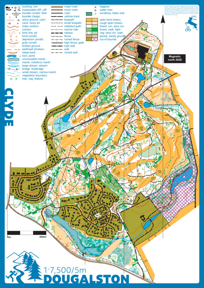
Douglaston is a designed landscape in multiple ownership containing a golf course, a sporting…
Dumbarton
nr. Dumbarton
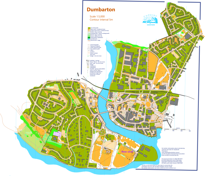
Interesting mixture of town centre, parkland, housing and industrial estate. Mapped by Dave…
Dunrod Hill
nr. Greenock
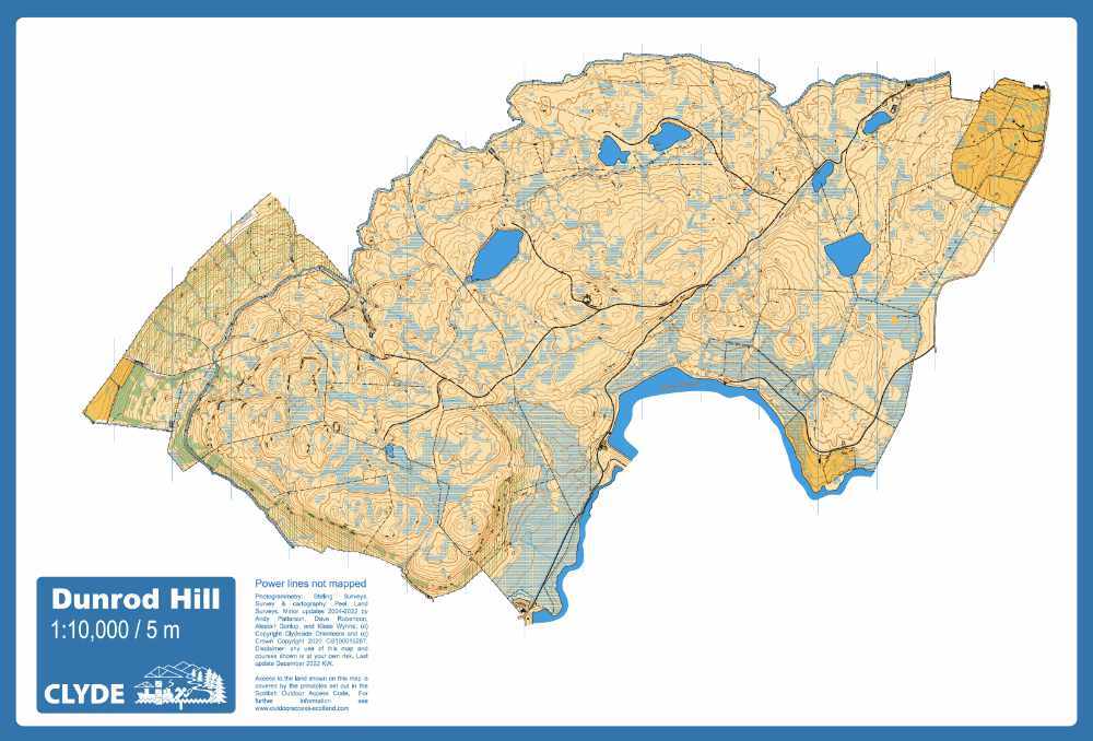
Rising to 298m above Greenock this is a classic large area of open moorland. There is a lot of…
Erskine
nr. Erskine
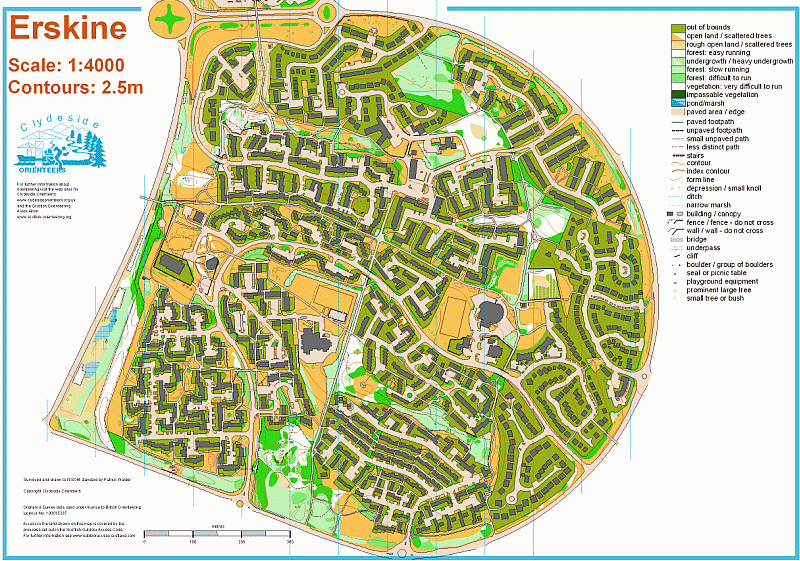
Erskine is a superbly intricate urban area. Mapped to ISSOM standard by Patrick and used for…
Garelochhead
nr. Garelochhead
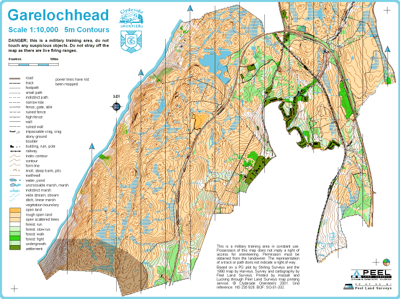
Round the end of the Gare Loch this military training area is largely open moorland with lost of…

Glenorchard
nr. Balmore
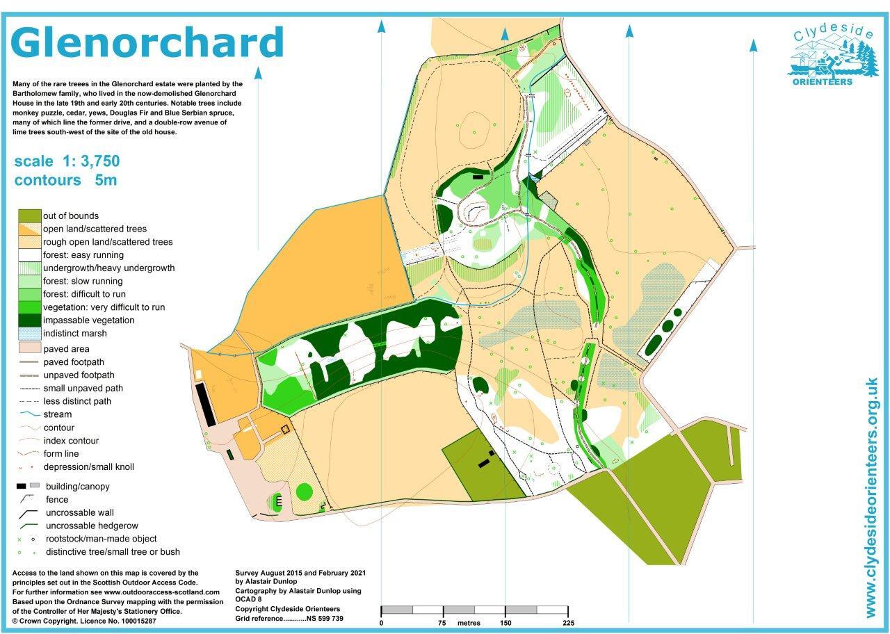
A small area for training and school use initially mapped in 2015 and updated in 2021. Site of the…
Houston & Crosslee
nr. Houston
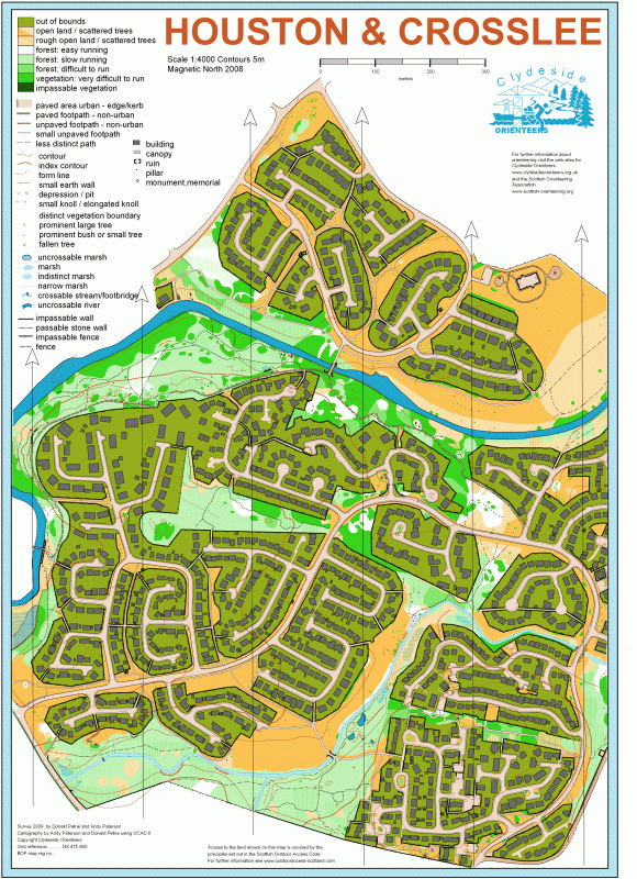
This largely urban map was produced by local residents Donald and Andy. It is an interestingly…
Houston House Woods
nr. Houston

A small area of woodland and fast open fields with many horse jumps to confuse the unwary. Used for…
Kelvin North
nr. Glasgow

The Kelvin North urban sprint map (ISSprOM 2019-2) comprises the runnable areas around the river…
Kelvin South
nr. Glasgow
The map (October 2025, ISSprOM 2019-2 by Klaas Wynne) comprises the main (Gilmorehill) campus of…
Knockmountain
nr. Kilmacolm
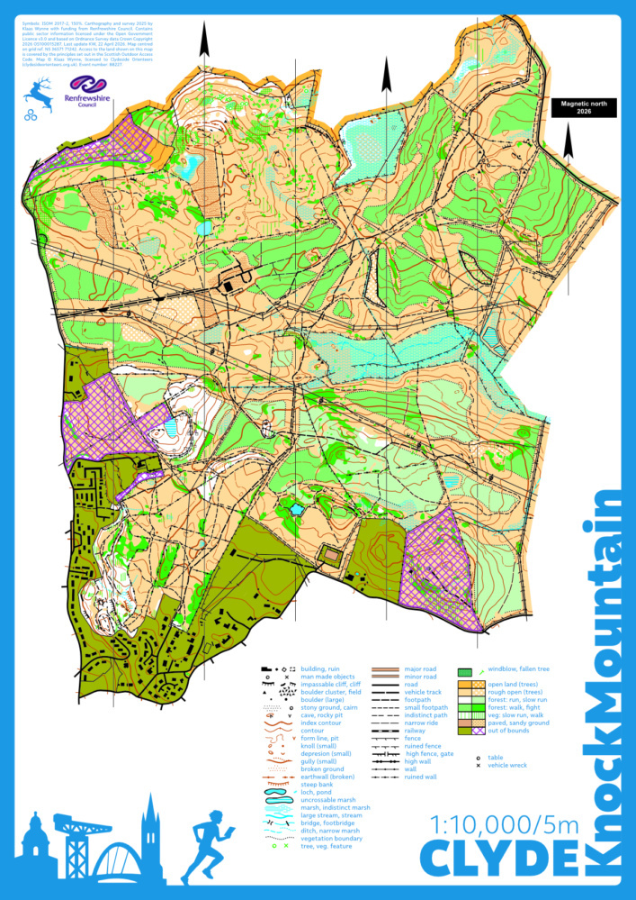
The majority of the area on the Knockmountain map is owned and managed by Forestry and Land…
Linwood Moss
nr. Linwood
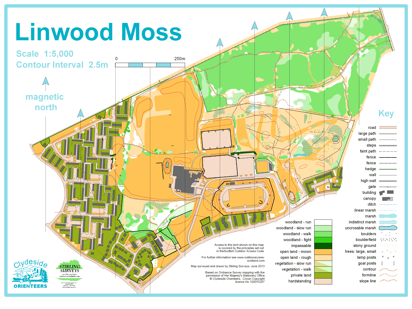
A wonderfully mixed area of housing estate, parkland, semi-wild open, and dense woodland. An…
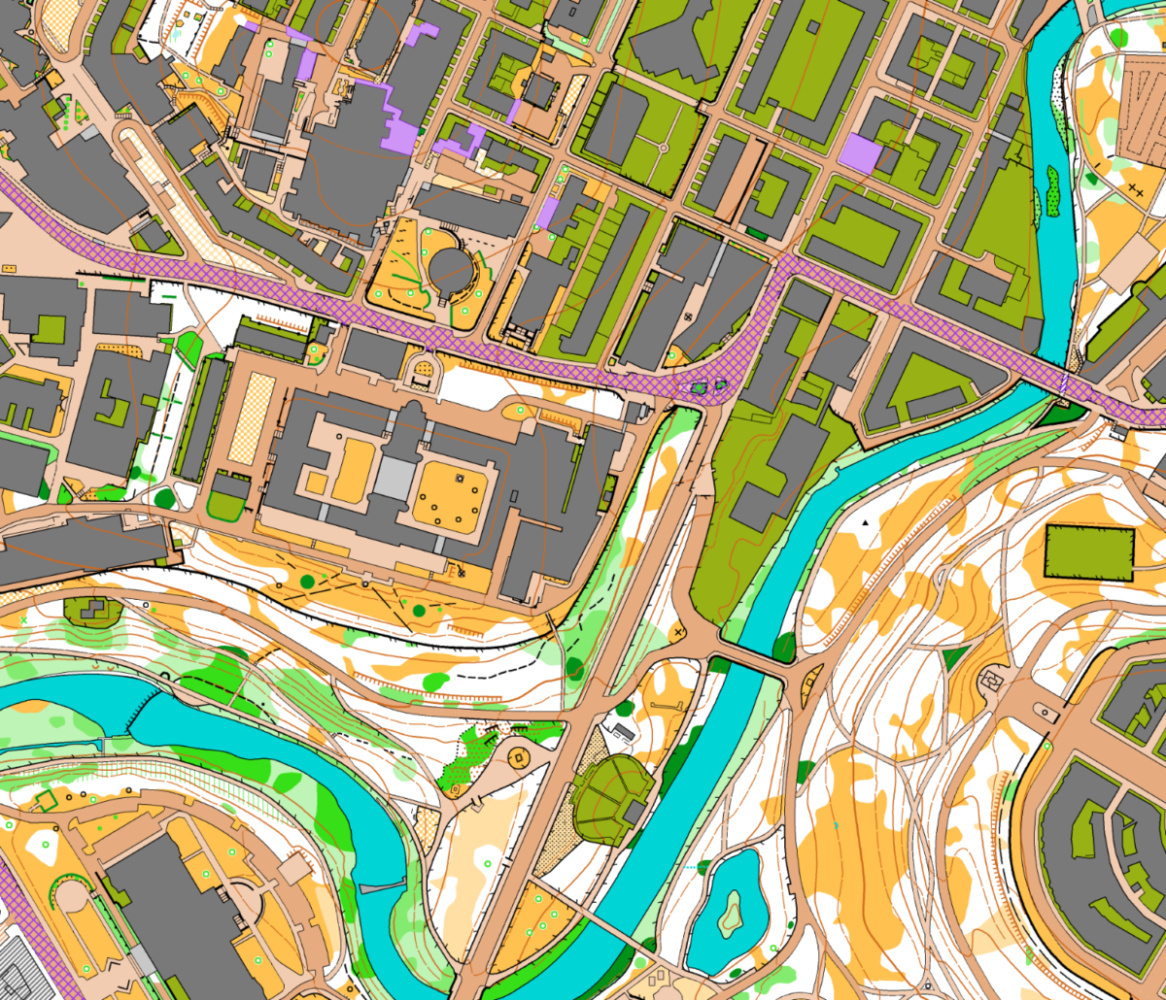
M8dness (Garnethill)
nr. Glasgow
Map under and around the M8 motorway of Glasgow's Garnethill area, Chinatown, Dundasvale Court…
Mains Estate
nr. Milngavie
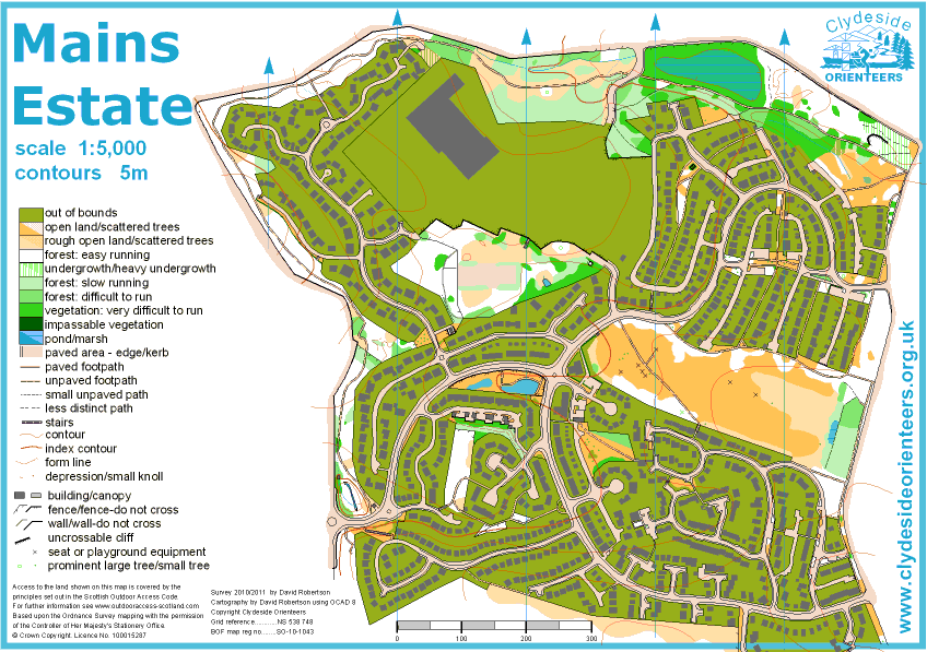
Mains Estate has a wide variety of terrain from complex urban areas to runnable woodlands. It…
Milngavie
nr. Milngavie
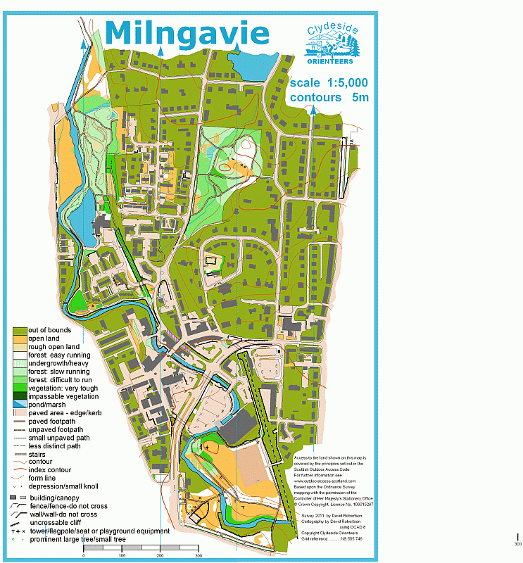
Milngavie Town Centre ISSOMAn interestingly varied sprint area including parkland, complicated…

Mosshead
nr. Milngavie
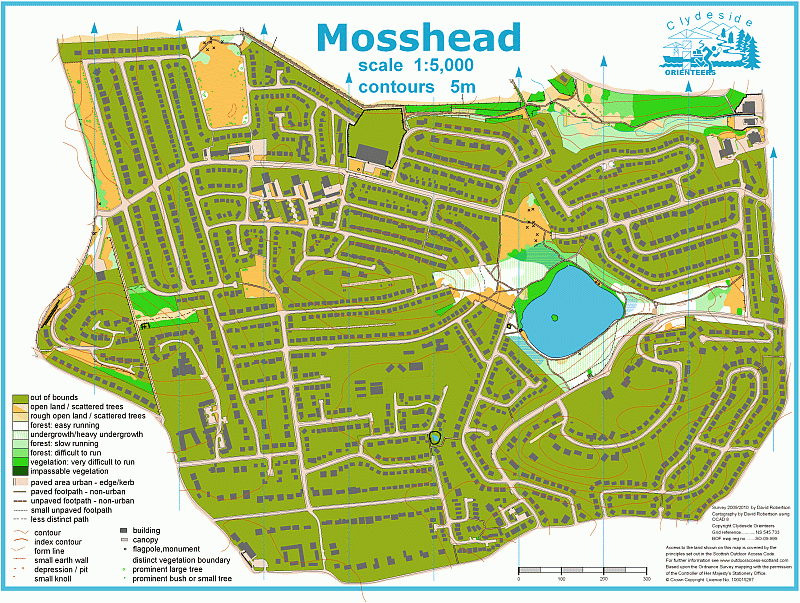
An urban map of the Mosshead suburb of Glasgow produced by local resident Dave. The mapped area is…
Mugdock and Craigallian
nr. Milngavie
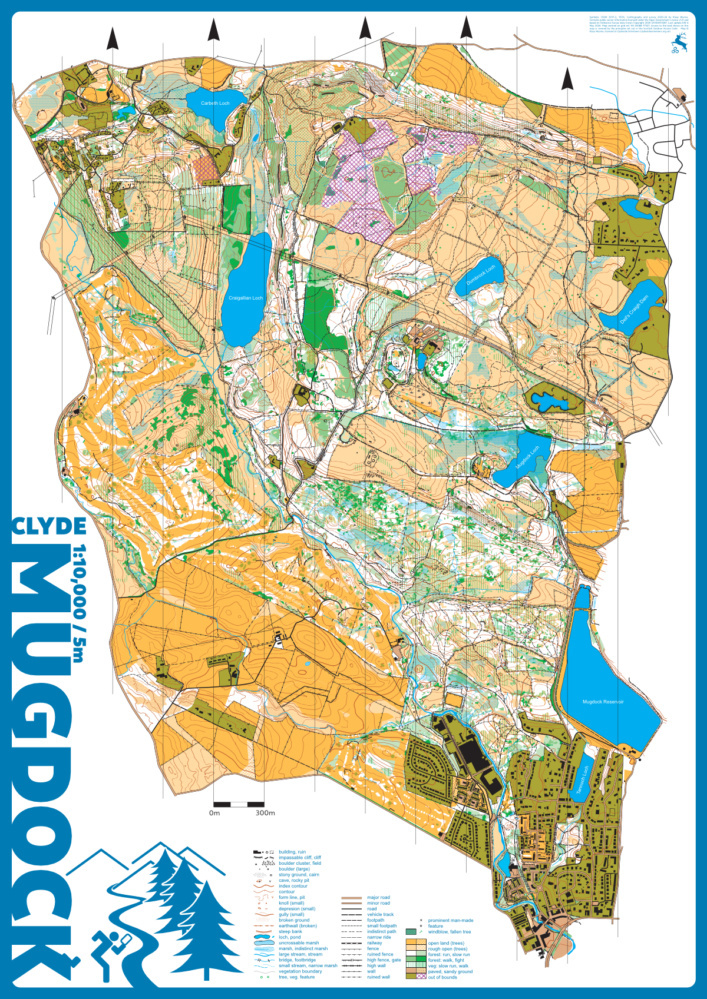
Mugdock Country Park, the Dumbrock area to the north, the Craigallian Estate and Carbeth area to…
Paisley city centre
nr. Paisley
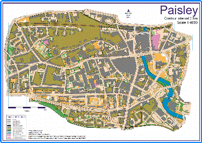
Mapped in late 2015 by GB elite orienteer Graham Gristwood, and first used for the Paisley city…
Ross Wood and Rowardennan
nr. Balmaha
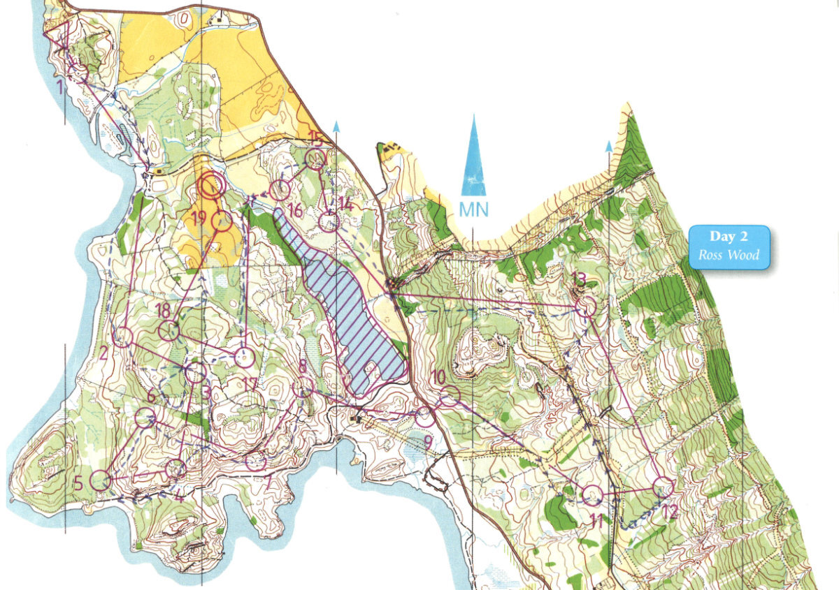
Ross Wood and Rowardennan were used in the 1989 Scottish Six Days and local events and has fallen…
Rouken Glen
nr. Giffnock
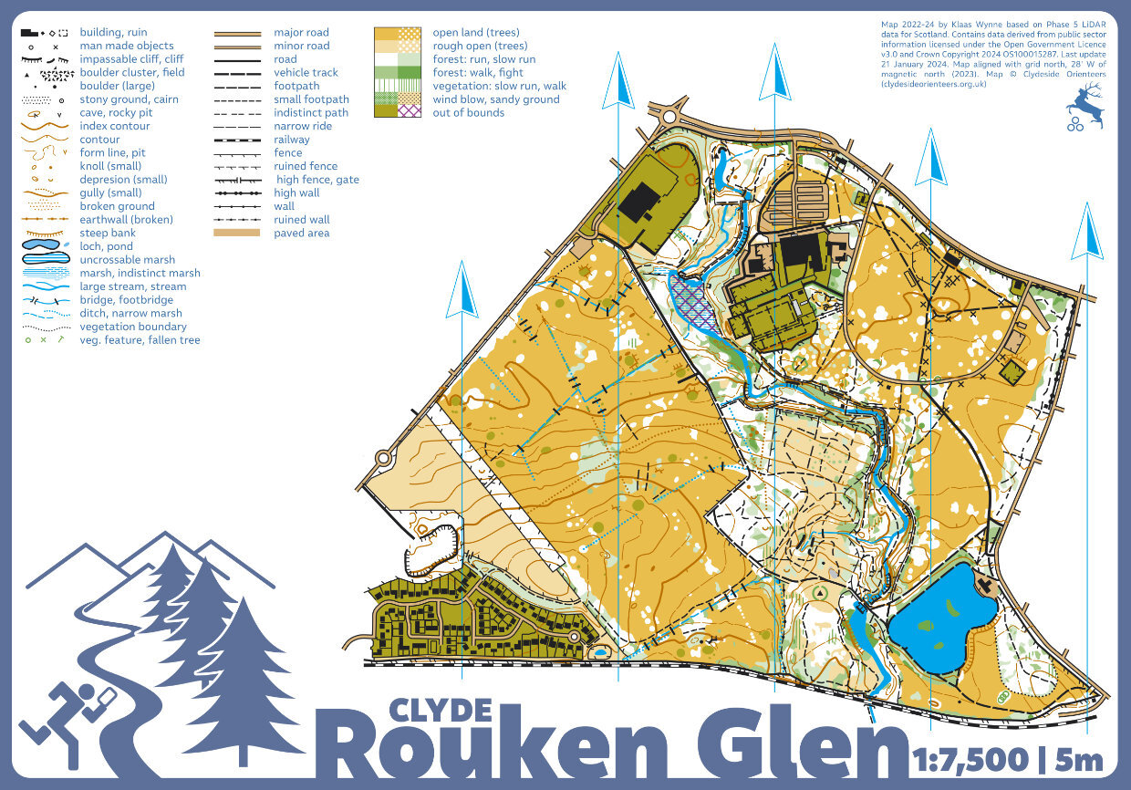
Rouken Glen is a delightful urban park in the south side of Glasgow with the Auldhouse Burn running…

The Slacks
nr. Bowling
Rising to 365m above the Clyde Estuary The Slacks is an area of open hillside overlooking the…
Whitelee windfarm
nr. Eaglesham
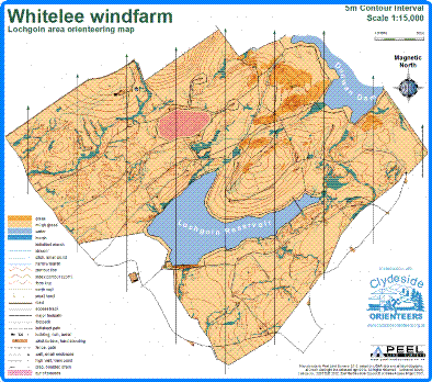
A new orienteering map of Whitelee windfarm, commissioned by East Renfrewshire Council, who hold…
Windy Hill
nr. Lochwinnoch
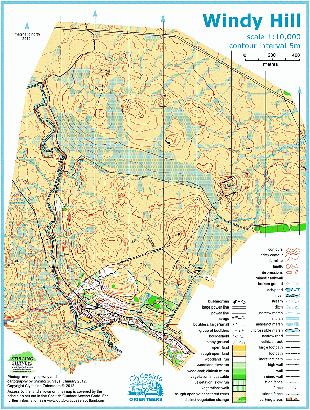
Open moorland beside Muirshiel Country Park. Nice contour features and a lot of surprising rock on…