
Garnethill M8dnessThu 16 Jun, 2022
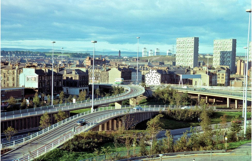
M8 at St George's Cross
Photographer:
Glasgow Motorway Archive
Spring Evenings #5
Local level event
Explanation of Event levels
Local events are usually low key and in the 'localised' area, ideal for newcomers to try the sport and Training events are non competitive and used for training and coaching, aimed at members of the club, but they can attract people from neighbouring clubs, and are often ideal for newcomers to try the sport. Regional events attract participants from around the local Region, National events are high quality competitions that will attract people from far away, Major events are Major Events such as a British Championships.
Terrain type: Urban
Overview
Spring evening informal event - Two urban course options (long and short) to test your navigation, including underpasses and overpasses around the Garnethill section of the M8, which was completed 50 years ago.
Location Info
/-4.2623,55.8693,12/500x400?access_token=pk.eyJ1IjoicGF1bGZyb3N0IiwiYSI6ImNrb3dtYXoycjA2NGMyeHQ2bmRqMnFrZjIifQ.nP5lTcgIDEirGf32roluZg)
Near: Glasgow Lat,Lng: 55.8693,-4.2623 Postcode: G4 9JT
Open an interactive map in:
GoogleMap -
OpenStreetMap -
BingMap (OS 50k)
Directions / Parking
New City Road Chinatown car parks.
Map / Terrain
1:4,000 new urban map drawn according to ISSprOM 2019-2 standards by Klaas Wynne based on OS aerial photography. The M8 and other major roads are, of course, strictly out of bounds.
Course Information
Long (3.4km, ~5.5km practical) and short (2.2km) options will be available. Control descriptions are printed on the map. You will be allowed to look at the map 2 minutes before your start, in order to make the wisest route choice for longish leg 1. Use your time on leg 1 wisely to plan for the subsequent legs.
Note that ISSprOM 2019-2 allows for two levels. Familiarise yourself with "Area passable at two levels", "Bridge or tunnel entrance" and "Underpass or tunnel", as these will all be used on the map.
MapRun 6.5 for smartphones will be the preferred option (although courses can also be run without using this). Controls will be marked using small 7×7cm cards (see picture below), which have NFC tags attached. The MapRun courses will use both GPS and NFC control punching, the latter are more reliable when GPS fails near tall buildings. Either way, you are expected to tag the control cards. As this is a busy urban area, there is a chance that somebody will rip some of the cards off. The controls are hopefully obvious enough (and GPS-based punching reliable enough) that this will not pose a real problem if that were to happen.
This is a fully urban course and studded shoes will not offer any advantage in this case.
Entry Details
Please enter via this googleform registration form by 11pm on Monday 13th June (separate form per each individual entry).
Info on how to pay the entry fee will be sent via e-mail after entry (£3 adults, £1.50 juniors/students).
Registration and Start times
Starts 6.30pm -7.00pm
Courses close 8.00pm
Dog restrictions
Well-behaved dogs on a lead
Contacts / Officials
treasurer at clydesideorienteers.org.uk
Nearest A&E Hospital
Glasgow Royal Infirmary, 84 Castle Street, G4 0SFSafety Notes
Covid - please do not attend if you have Covid, or Covid symptoms.
This is an urban area, all courses involve road crossings. The M8 and other major roads are strictly out of bounds, and will be marked as such on the map using pink hatching.
Competitors are responsible for their own safety.
Children must be accompanied by a responsible adult.