Spring Evening Series #2Thu 25 Apr, 2024
Spring Evening Series
Local level event
Explanation of Event levels
Local events are usually low key and in the 'localised' area, ideal for newcomers to try the sport and Training events are non competitive and used for training and coaching, aimed at members of the club, but they can attract people from neighbouring clubs, and are often ideal for newcomers to try the sport. Regional events attract participants from around the local Region, National events are high quality competitions that will attract people from far away, Major events are Major Events such as a British Championships.
Terrain type: Woodland
Results
Overview
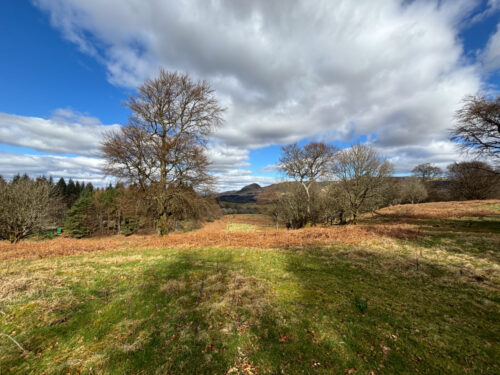
Although Carbeth was mapped in 1982, there is no record of any orienteering taking place there. Carbeth is known for the Hutters Community (https://www.carbethhutters.co.uk/), which is sitting on the western edge of a small moorland hill (185m) surrounded by wooded sections. The Long and Short courses will make full use of this small but technically quite challenging area using a new (2024) map.
Mapper / Planner / Organiser: Klaas Wynne
Location Info
Near: Carbeth Lat,Lng: 55.9814,-4.3661 OS Grid Ref: NS524790 Postcode: G63 9AY What3Words: //////textiles.deodorant.jacket
Open an interactive map in:
GoogleMap -
OpenStreetMap -
BingMap (OS 50k)
Map / Terrain
New 1:7,500 map of Carbeth by Klaas Wynne (last update March 2024) using 5m contours. This area does not appear to have been used since the 1980s or possibly earlier. The course maps will be A4 and printed on waterproof paper. The control descriptions will be printed on the map (no loose control descriptions).
Mixed terrain: tracks around the huts, open moorland, old growth oak wood, denser plantation, gravel/muddy paths, died down bracken, and marshes. Although the area is small and can therefore never really be TD5, the Long/Short courses do have some technically challenging legs.
Course Information
Long course: 5.0 km / 200m
Short course: 2.9km / 120m
Novice course: 1.5 km
SPORTIdent will be used and contactless punching (SIAC) will be activated
We will have SIs for hire free of charge but there is a £30 charge if lost
Entry Details
Enter here (entries close at 20:00 on 23 April)
Registration and Start times
Starts 6.30-7.00, courses close 8.00 and controls will be collected in after that. You must report to Download, even if you do not complete your course, so we know you are back safely and don’t have to mount a search for you. The start is located about 150 metres from registration/parking.
Facilities
There are no toilets available.
Dog restrictions
Well-behaved dogs on a lead.
Contacts / Officials
Please contact Klaas Wynne if you have any questions.
Nearest A&E Hospital
Queen Elizabeth University Hospital, 1345 Govan Rd, GlasgowSafety Notes
Studded shoes required for Long/Short courses, backup mobile phone recommended. The area is used by the general public including dog walkers, cyclists and families. Please respect their right to be there at the same time as you are orienteering. A comprehensive risk assessment has been carried out by the organisers, but participants take part at their own risk and are responsible for their own safety during the event. Children must be accompanied by a responsible adult. Any participants with relevant pre-existing medical conditions which might affect their participation should disclose them to the race organisers before they start.


/-4.3661,55.9814,12/500x400?access_token=pk.eyJ1IjoicGF1bGZyb3N0IiwiYSI6ImNrb3dtYXoycjA2NGMyeHQ2bmRqMnFrZjIifQ.nP5lTcgIDEirGf32roluZg)