
Auchengillan map
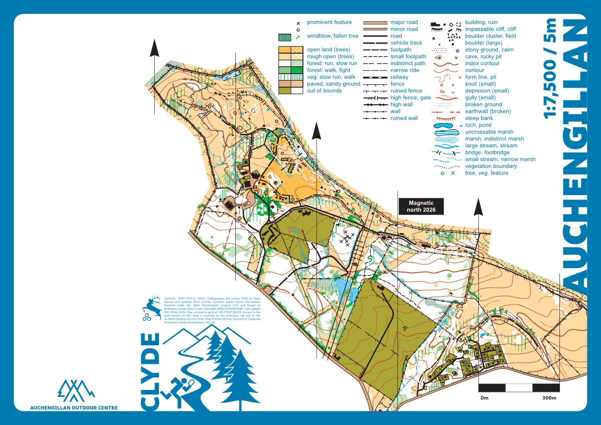
Auchengillan
Information
Auchengillan International Outdoor Centre is owned and operated by the Greater Glasgow Scout Council. The map has a mixture of open grassland, patches of fast forest, buildings, and fenced enclosures. There is a reasonable amount of contour, rock, and marsh detail. The area is ideal for short training courses and sprint races. It even has indoor toilets.
The map was completely redrawn (KW, 2024).
Location
Near: Blanefield Lat,Lng: 55.9925,-4.3746 OS Grid Ref: NS518804 Postcode: G63 9AU What3Words: ///slanting.responds.depths
/-4.3746,55.9925,12/500x400?access_token=pk.eyJ1IjoicGF1bGZyb3N0IiwiYSI6ImNrb3dtYXoycjA2NGMyeHQ2bmRqMnFrZjIifQ.nP5lTcgIDEirGf32roluZg)
Open an interactive map in:
GoogleMap -
OpenStreetMap -
BingMap (OS 50k)