
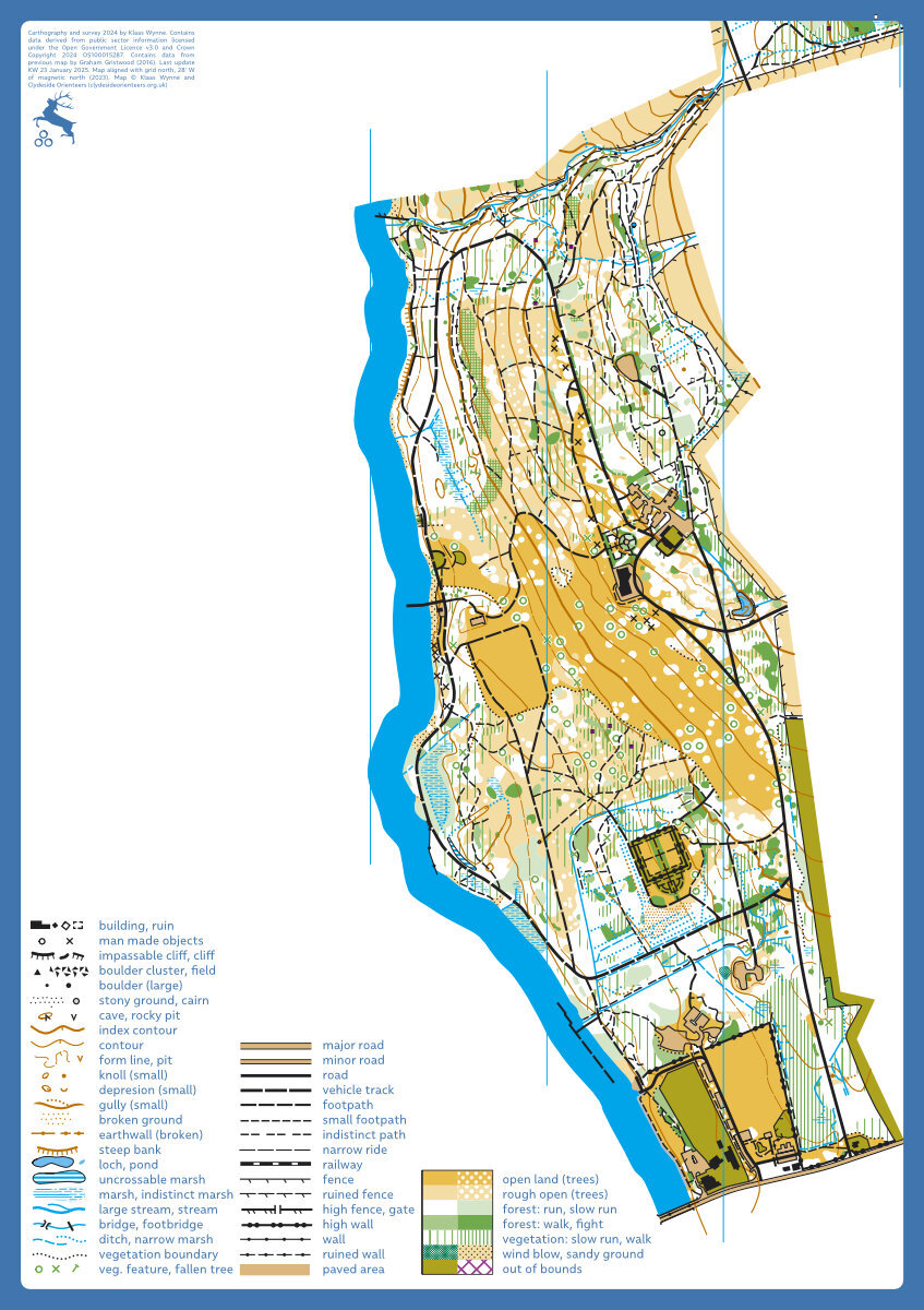
Balloch Country Park map
Balloch
Information
Balloch Country Park is on the southeastern shores of Loch Lomond and easily accessible by car and public transport. It provides a mixture of runnable park land, runnable forest, reasonable contour detail, buildings, a walled garden and a castle, and has great views over Loch Lomond. The moat of the original castle from 1238 is a great control location. It has public toilet facilities and pets are welcome.
The original map was made by GB elite orienteer Graham Gristwood in 2016 with funding from West Dunbartonshire Council, West Dunbartonshire Leisure, and Loch Lomond & the Trossachs National Park. The map is being updated and expanded to include neighbouring Whinney Hill (KW, ~12/2024)
Location
Near: Balloch Lat,Lng: 56.0131,-4.5836 Postcode: G83 8JW What3Words: ///twig.flickers.dominate
/-4.5836,56.0131,12/500x400?access_token=pk.eyJ1IjoicGF1bGZyb3N0IiwiYSI6ImNrb3dtYXoycjA2NGMyeHQ2bmRqMnFrZjIifQ.nP5lTcgIDEirGf32roluZg)
Open an interactive map in:
GoogleMap -
OpenStreetMap -
BingMap (OS 50k)