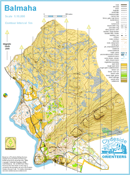
Balmaha map
Information
The map extends from the shores of Loch Lomond to the top of Conic Hill. Most of the area is open with reasonabley fast running but the unwary will be caught out by the wealth of rock and contour detail and the absence of line features on the higher slopes. The lower slopes have a mixture of open natural woodland and plantation. The views from the higher slopes are magnificant. There is a carpark with a visitor centre and toilets on the edge of the map in Balmaha.
Location
Near: Balmaha Lat,Lng: 56.0853,-4.5395 Postcode: G63 0AH What3Words: ///inversion.flipper.rust
/-4.5395,56.0853,12/500x400?access_token=pk.eyJ1IjoicGF1bGZyb3N0IiwiYSI6ImNrb3dtYXoycjA2NGMyeHQ2bmRqMnFrZjIifQ.nP5lTcgIDEirGf32roluZg)
Open an interactive map in:
GoogleMap -
OpenStreetMap -
BingMap (OS 50k)

