
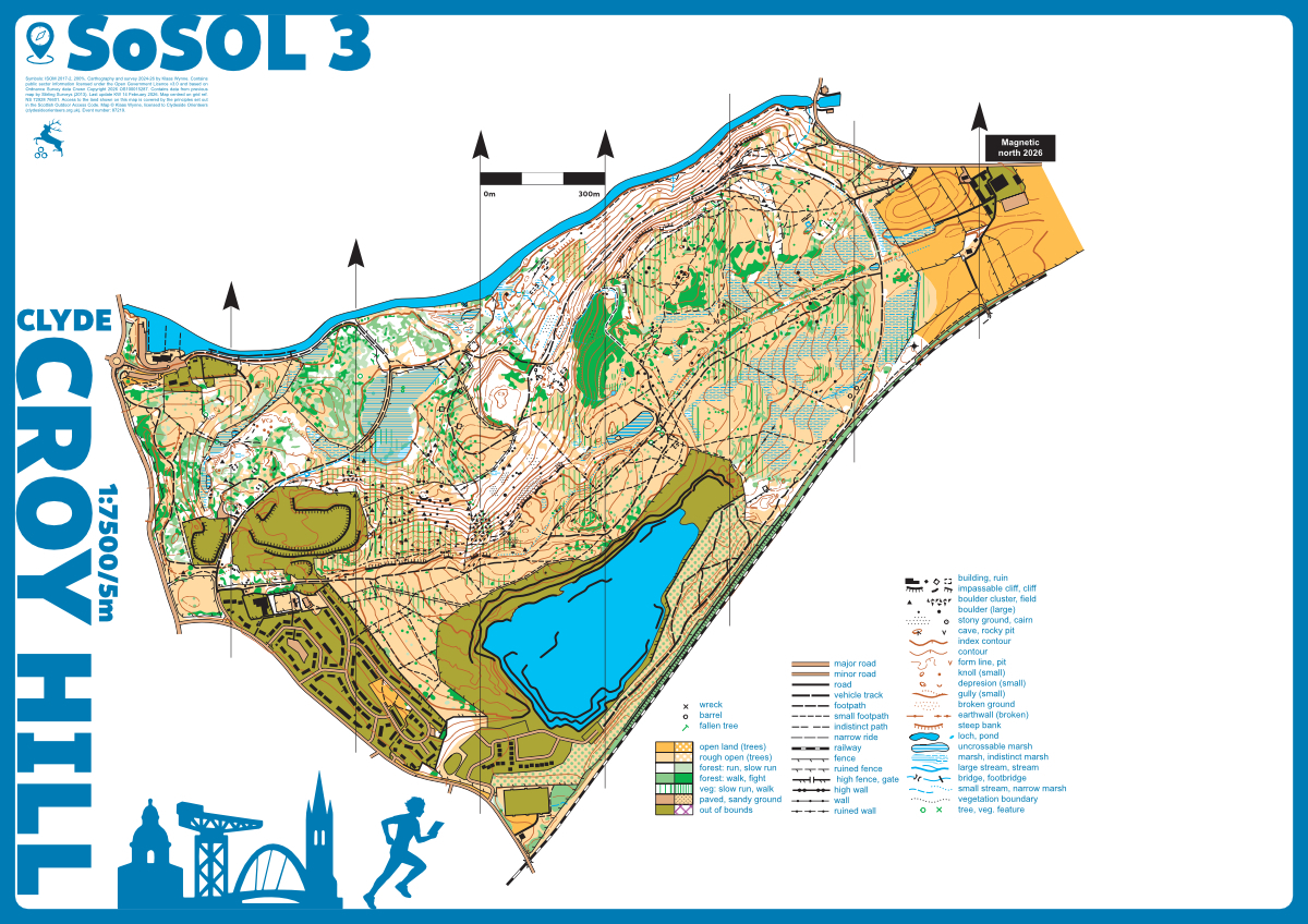
Croy Hill map
Croy
Information
Croy Hill is situated near Kilsyth and is easily accessible by car (parking at Auchinstarry Marina) and public transport (train station Croy). Croy Hill is located on the Antonine Wall and contains the remains of a Roman fortlet on its summit. Although the Antonine Wall has largely disappeared over the ages, the ditch in front of the rampart is still very visible and has been used to locate orienteering controls in the past. The area contains a mixture of old woodland, regenerated mining areas, and open grassland. It has lots of interesting detail and is ideal for sprint and middle distance races.
Croy Hill was completely remapped (KW, 2024).
Location
Near: Kilsyth Lat,Lng: 55.9665,-4.0351 Postcode: G65 0PR What3Words: ///ideas.unsigned.perfumed
/-4.0351,55.9665,12/500x400?access_token=pk.eyJ1IjoicGF1bGZyb3N0IiwiYSI6ImNrb3dtYXoycjA2NGMyeHQ2bmRqMnFrZjIifQ.nP5lTcgIDEirGf32roluZg)
Open an interactive map in:
GoogleMap -
OpenStreetMap -
BingMap (OS 50k)