
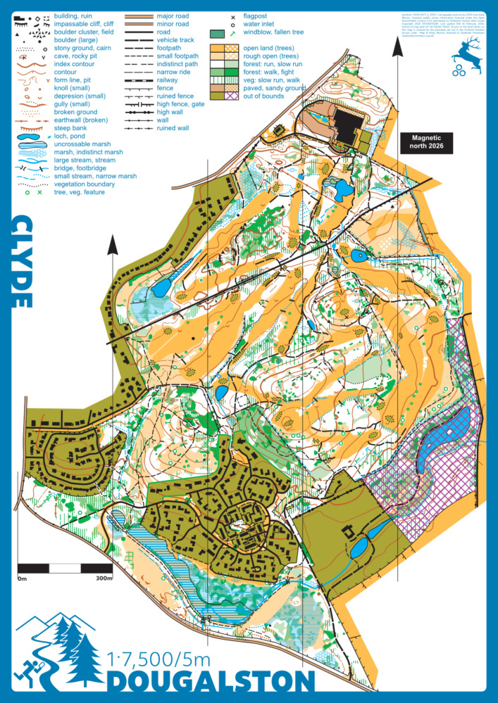
Dougalston map
Dougalston
Information
Douglaston is a designed landscape in multiple ownership containing a golf course, a sporting complex, and a housing development. It is (for now) only accessible under the Scottish Outdoor Access Code. The area is small but surprisingly hilly and complex, providing good running on (golf course) grass and (mostly) open woodland largely composed of mixed broadleaved trees dominated by beech. It is ideal for night orienteering when the golf course is not in use.
A new orienteering map (1:7,500, ISOM 2017-2) was prepared (KW 2024).
Location
Near: Glasgow Lat,Lng: 55.9422,-4.2979 Postcode: G62 8HA
/-4.2979,55.9422,12/500x400?access_token=pk.eyJ1IjoicGF1bGZyb3N0IiwiYSI6ImNrb3dtYXoycjA2NGMyeHQ2bmRqMnFrZjIifQ.nP5lTcgIDEirGf32roluZg)
Open an interactive map in:
GoogleMap -
OpenStreetMap -
BingMap (OS 50k)