
Dunrod Hill map
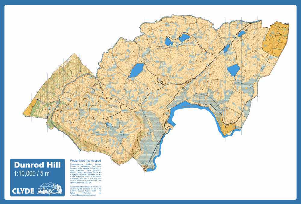
Dunrod Hill orienteering map
Information
Rising to 298m above Greenock this is a classic large area of open moorland. There is a lot of contour and rock detail with extra interest added by various bits of industrial archeology. During the Industrial Revolution the area was used to supply water to Greenock leaving a number of reservoirs both large and small, and an 8km aqueduct, the Greenock Cut, running round the foot of the hillside. Amazing views of the Clyde coast on a clear day! The Greenock Cut visitor centre has toilets, educational displays and a small cafe.
Location
Near: Greenock Lat,Lng: 55.9115,-4.8235 OS Grid Ref: NS247721 Postcode: PA16 9NB What3Words: ///paddocks.bleat.bypassed
/-4.8235,55.9115,12/500x400?access_token=pk.eyJ1IjoicGF1bGZyb3N0IiwiYSI6ImNrb3dtYXoycjA2NGMyeHQ2bmRqMnFrZjIifQ.nP5lTcgIDEirGf32roluZg)
Open an interactive map in:
GoogleMap -
OpenStreetMap -
BingMap (OS 50k)