
Doon Hill and Fairy Knowe map
Doon Hill and Fairy Knowe
Information
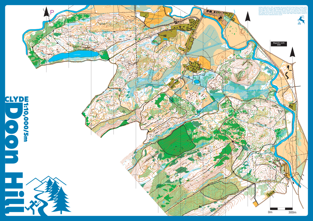
This area to the southwest of Aberfoyle has pretty much everything. Lots of good contour and rock detail, with the occasional marsh thrown in. The vegetation is a mix of deciduous woodland and mature plantation. The map was originally drawn by Donald Petrie in the 1980s, completely remapped by Marcus Pinker in 2012, and updated and extended to the north-west by Jon Musgrave in 2016. The map has been extended further west, completely redrawn using new (2023) LiDAR data and fully conforming ISOM 2017-2 by Klaas Wynne in 2023-25.
The mapped area comprises a mixture of mature deciduous and technical plantation forest as well as extensive sections of ancient temperate rainforest oak woodland. Most of the area is very runnable aside from some patches of bracken which die back in the autumn and shouldn’t affect running speeds significantly until the end of May. Some of the mature working coniferous plantation has been affected by winter gales and subsequent forestry operations to extract fallen timber. The area is packed with interesting detail and should offer a great orienteering challenge.
Location
Near: Aberfoyle Lat,Lng: 56.1781,-4.3838 Postcode: FK8 3UG What3Words: ///force.assembles.tiptoes
/-4.3838,56.1781,12/500x400?access_token=pk.eyJ1IjoicGF1bGZyb3N0IiwiYSI6ImNrb3dtYXoycjA2NGMyeHQ2bmRqMnFrZjIifQ.nP5lTcgIDEirGf32roluZg)
Open an interactive map in:
GoogleMap -
OpenStreetMap -
BingMap (OS 50k)