
Glenorchard map
Glenorchard ISSOM 2021 final
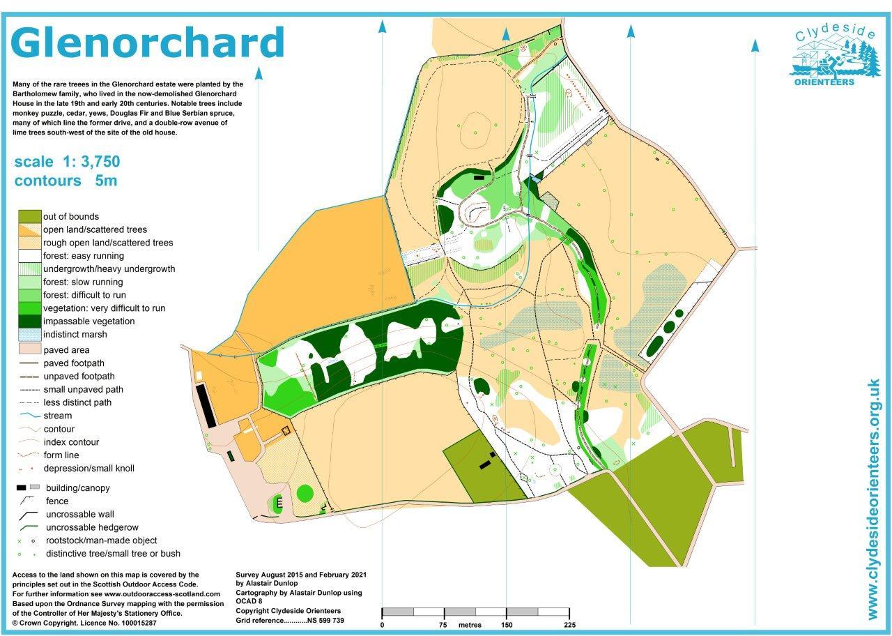
Information
A small area for training and school use initially mapped in 2015 and updated in 2021. Site of the Glenorchard Estate and now-demolished house, with many distinguished trees over 100 years old.
Location
Near: Balmore Lat,Lng: 55.938,-4.2435 Postcode: G64 4AW
/-4.2435,55.938,12/500x400?access_token=pk.eyJ1IjoicGF1bGZyb3N0IiwiYSI6ImNrb3dtYXoycjA2NGMyeHQ2bmRqMnFrZjIifQ.nP5lTcgIDEirGf32roluZg)
Open an interactive map in:
GoogleMap -
OpenStreetMap -
BingMap (OS 50k)