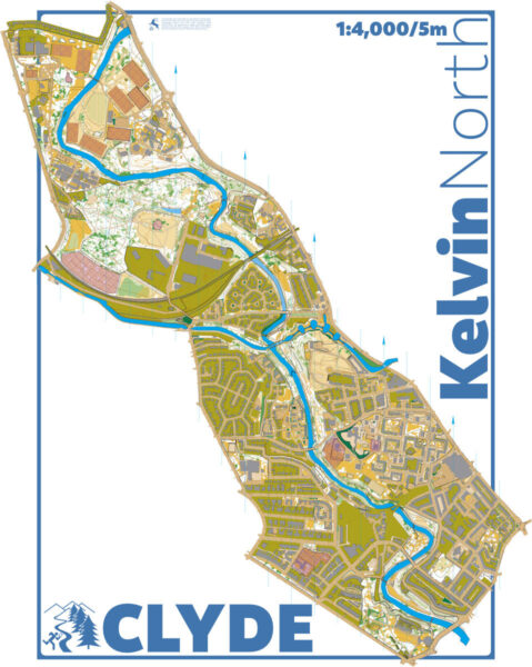
Kelvin North map
Information
The Kelvin North urban sprint map (ISSprOM 2019-2) comprises the runnable areas around the river Kelvin flowing through Glasgow's West End, from the University of Glasgow Garscube Campus (left and right bank) and Dawsholm Park (right bank), through Kelvindale and the Wyndford, all the way to the Glasgow Botanic Gardens. An earlier version of the map (Garscube Campus and Dawsholm Park only) has been used for a number of orienteering training runs. On the north end, the University of Glasgow Garscube Sports Complex could provide facilities including parking. On the southern end, the Brewhaus pub and beer garden (used in a famous scene in the 1996 film Trainspotting) could provide a base with on street parking.
The map was completely redrawn (KW, 2024) to ISSprOM 2019-2 standard.
Location
Near: Glasgow Lat,Lng: 55.8983,-4.3034
/-4.3034,55.8983,12/500x400?access_token=pk.eyJ1IjoicGF1bGZyb3N0IiwiYSI6ImNrb3dtYXoycjA2NGMyeHQ2bmRqMnFrZjIifQ.nP5lTcgIDEirGf32roluZg)
Open an interactive map in:
GoogleMap -
OpenStreetMap -
BingMap (OS 50k)

