
Knockmountain map
Knockmountain
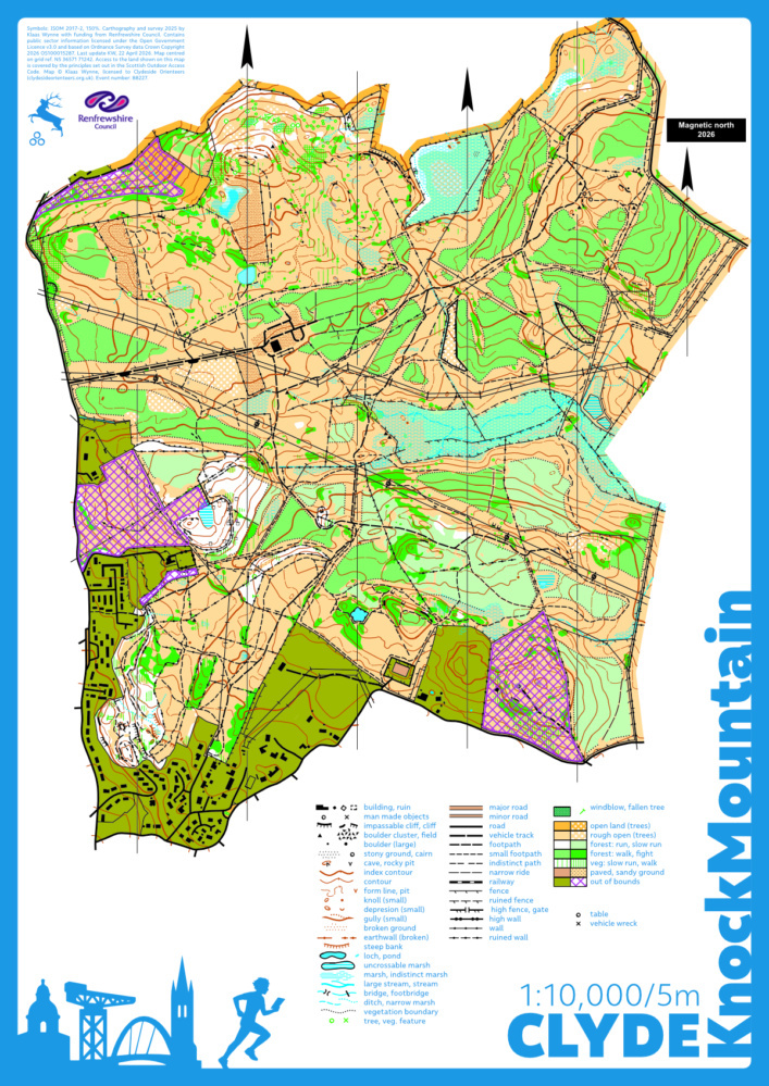
Information
The majority of the area on the Knockmountain map is owned and managed by Forestry and Land Scotland with the section closest to Kilmacolm in community ownership. It contains areas of productive plantation that are currently (2025) too dense for running but are likely to become runnable in the near future. This is interspersed by more open hillsides with gorse bushes as well as old growth forest, with a fair amount of contour detail and many boulders, crags, and rocky outcrops. Unlike many such areas in Scotland, Knockmountain has very little in the way of bracken (except at the far northwestern end) and instead the open areas are covered in rye grass and wild flowers attracting a host of insects (some of the bitey kind...).
Orienteering map (ISOM 2017) made by Klaas Wynne for Clyde funded by Renfrewshire Council, August 2025.
Location
Near: Kilmacolm Lat,Lng: 55.9059,-4.6146 Postcode: PA13 4PT
/-4.6146,55.9059,12/500x400?access_token=pk.eyJ1IjoicGF1bGZyb3N0IiwiYSI6ImNrb3dtYXoycjA2NGMyeHQ2bmRqMnFrZjIifQ.nP5lTcgIDEirGf32roluZg)
Open an interactive map in:
GoogleMap -
OpenStreetMap -
BingMap (OS 50k)