
Milngavie map
Milngavie
Information
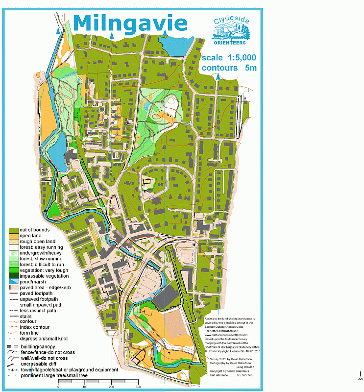
Milngavie Town Centre ISSOM
An interestingly varied sprint area including parkland, complicated housing estates, woodland, bridges and underpasses, railways and supermarkets. A great test of varying pace and skills.
Mapped by Dave Robertson.
Location
Near: Milngavie Lat,Lng: 55.9421,-4.3108 Postcode: G62 8DR What3Words: ///newly.photos.leads
/-4.3108,55.9421,12/500x400?access_token=pk.eyJ1IjoicGF1bGZyb3N0IiwiYSI6ImNrb3dtYXoycjA2NGMyeHQ2bmRqMnFrZjIifQ.nP5lTcgIDEirGf32roluZg)
Open an interactive map in:
GoogleMap -
OpenStreetMap -
BingMap (OS 50k)