
Mugdock and Craigallian map
Mugdock orienteering map
Information
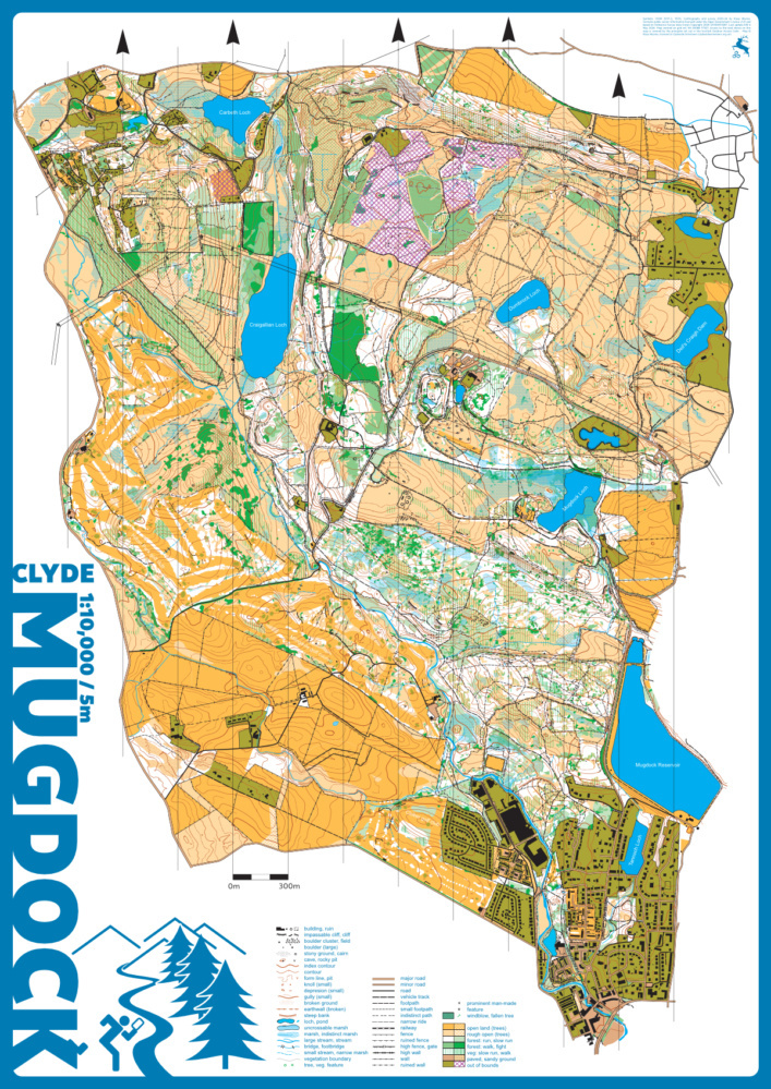
Mugdock Country Park, the Dumbrock area to the north, the Craigallian Estate and Carbeth area to the west, and the Milngavie Hilton Park golf courses to the southwest provide a huge mixture of terrain and are a favourite CLYDE area. At the south end there is the urban environment of Milngavie town centre where the railway station and supermarket are on the map. The north has rough moorland and mixed plantation forest, while the middle section has areas of managed country park, old growth woodland, and moorland. Finally, there are even two ruined castles and some WWII archaeology to top it all off. There is a good network of paths through this varied terrain and areas of intricate details in contours, rock, and vegetation. The Mugdock CP visitor centre has toilets, cafes, a garden centre, a shop, and car parking. Carbeth has limited parking and the St Mocha drive through coffee shop.
The map was completely redrawn (KW, 2023).
There are even 2 ruined castles and some WWII archeology around. There is a good network of paths through this varied terrain and areas of intricate details in contours, rock and vegetation. The visitor centre has toilets with piped music, two different cafes, a garden centre and shop.
Location
Near: Milngavie Lat,Lng: 55.9704,-4.3299 OS Grid Ref: NS546779 Postcode: G62 8EL What3Words: ///boarding.hypocrite.commoners
/-4.3299,55.9704,12/500x400?access_token=pk.eyJ1IjoicGF1bGZyb3N0IiwiYSI6ImNrb3dtYXoycjA2NGMyeHQ2bmRqMnFrZjIifQ.nP5lTcgIDEirGf32roluZg)
Open an interactive map in:
GoogleMap -
OpenStreetMap -
BingMap (OS 50k)