
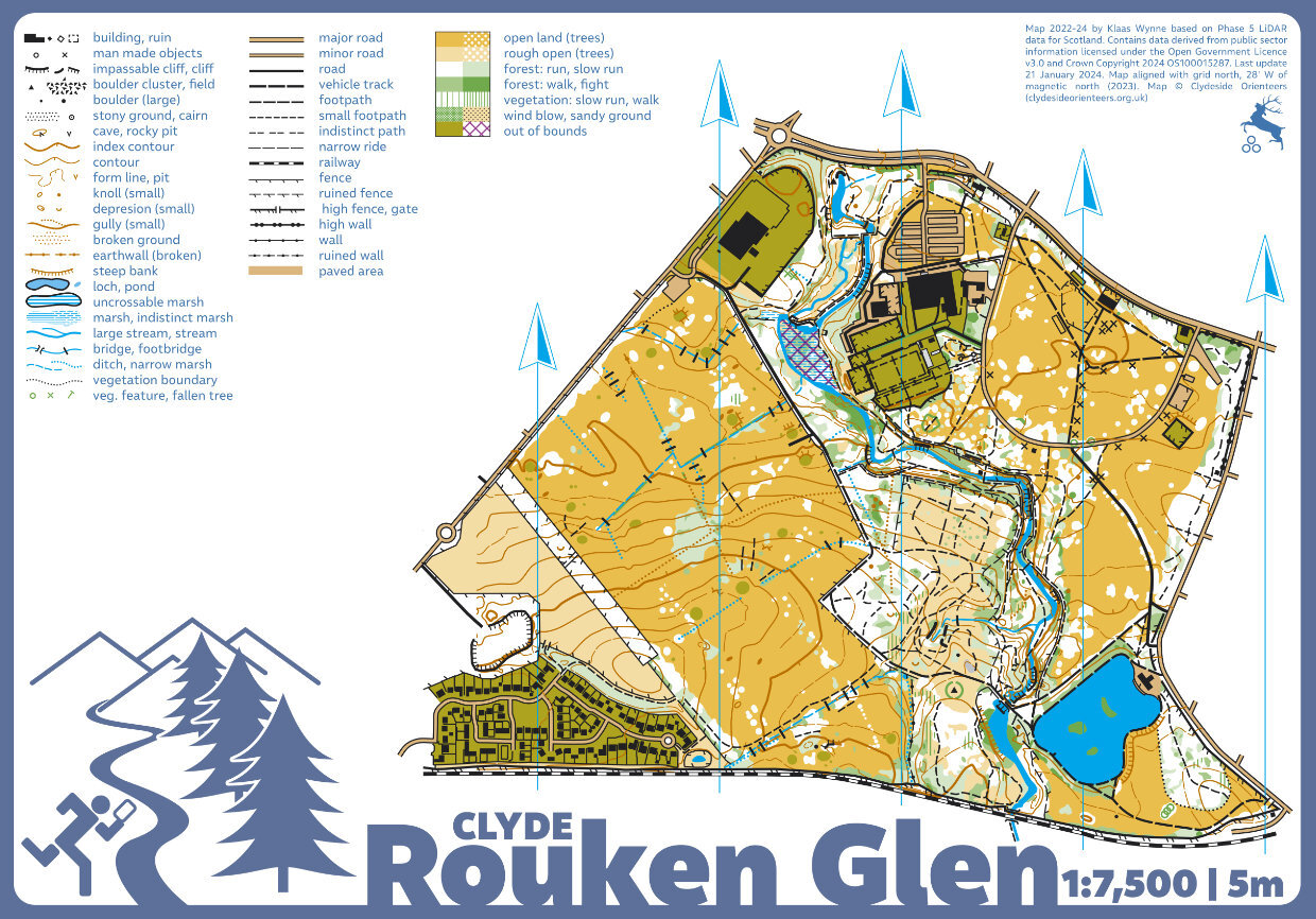
Rouken Glen map
Rouken Glen
Information
Rouken Glen is a delightful urban park in the south side of Glasgow with the Auldhouse Burn running through the centre of the map in a significant gorge with interesting rock and contour features along its length. The parkland to the east of the gorge is well manicured and very fast running with enough detail to confuse the unwary. To the west of the gorge the park is less manicured but still fast and pleasant running. To the southwest is the Rouken Glen Golf Course with well-maintained greens separated by forested sections. A good area for training events, sprint races, and night orienteering.
The map was completely redrawn and expanded to include the golf course (KW, 2024).
Location
Near: Giffnock Lat,Lng: 55.796,-4.3158 OS Grid Ref: NS545585 Postcode: G46 7UG What3Words: ///twin.gets.puts
/-4.3158,55.796,12/500x400?access_token=pk.eyJ1IjoicGF1bGZyb3N0IiwiYSI6ImNrb3dtYXoycjA2NGMyeHQ2bmRqMnFrZjIifQ.nP5lTcgIDEirGf32roluZg)
Open an interactive map in:
GoogleMap -
OpenStreetMap -
BingMap (OS 50k)