
Kelvin South map
Kelvin South
Information
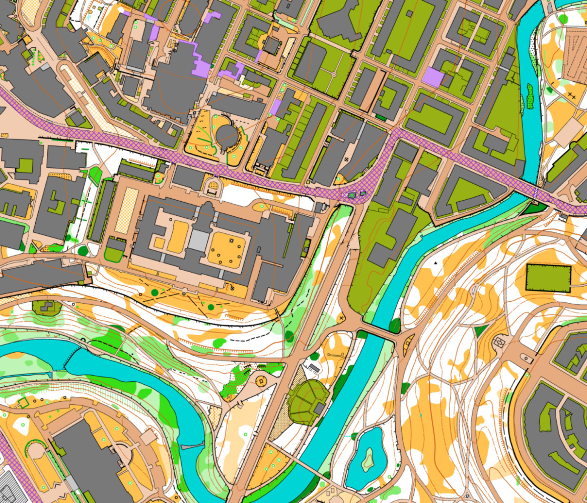
The map (October 2025, ISSprOM 2019-2 by Klaas Wynne) comprises the main (Gilmorehill) campus of the University of Glasgow, North Kelvinside up to Maryhill Road, Kelvingrove Park, and extends east to (and slightly over) the M8. Excellent combination of urban and park. Area used for the Glasgow City Race in 2007, club training events, and to be used for the 26th Glasgow Parks Champs No.966. Kelvingrove Park Sun 30 November, 2025 (joint STAG/CLYDE).
Location
Near: Glasgow Lat,Lng: 55.8712,-4.2884 Postcode: G12 8LZ
/-4.2884,55.8712,12/500x400?access_token=pk.eyJ1IjoicGF1bGZyb3N0IiwiYSI6ImNrb3dtYXoycjA2NGMyeHQ2bmRqMnFrZjIifQ.nP5lTcgIDEirGf32roluZg)
Open an interactive map in:
GoogleMap -
OpenStreetMap -
BingMap (OS 50k)