
Whitelee windfarm map
Whitelee Windfarm
Information
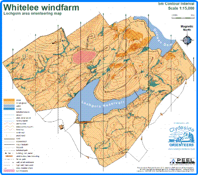
A new orienteering map of Whitelee windfarm, commissioned by East Renfrewshire Council, who hold the copyright. Clydeside Orienteers worked with the Whitelee rangers to produce a series of permanent courses (beginners, intermediate, advanced and 10k challenge). Maps are available at the visitor centre. Open moorland, wind turbines, detailed contour features and amazing views.
Location
Near: Eaglesham Lat,Lng: 55.7124,-4.3418 Postcode: G76 0QG What3Words: ///takes.campfires.juggles
/-4.3418,55.7124,12/500x400?access_token=pk.eyJ1IjoicGF1bGZyb3N0IiwiYSI6ImNrb3dtYXoycjA2NGMyeHQ2bmRqMnFrZjIifQ.nP5lTcgIDEirGf32roluZg)
Open an interactive map in:
GoogleMap -
OpenStreetMap -
BingMap (OS 50k)