
Virtual Orienteering CoursesOrienteering Anytime
Map Run phone app
- Home >
- Information >
- Go orienteering >
- Virtual Orienteering Courses
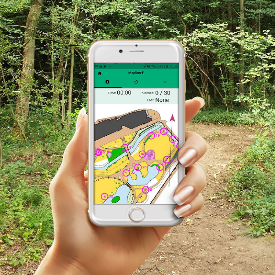
The MapRun orienteering app allows you to take part in “Virtual” orienteering courses using the GPS in your smartphone (or watch) at a time convenient for yourself. You run a course using either the map on your phone screen or a paper version, and your phone will beep when you reach the correct location of each control.
Clyde have a number of courses available that you can run any time you want to. They can be found on our Anytime Orienteering location map page.
The MapRun app is available for both iPhone, Android and some Garmin watches, and can be downloaded for free from your phone’s app store. Once you have the app on your phone you can enter your details (name etc.) and then select an event to run. Go to the “UK” folder and then “Scotland” then "Glasgow" and finally “Clydeside Orienteers”. Select the file for the course you want to run, e.g. “Baljaffray Med” and it will download the map and course to local storage on your phone (maybe a good plan to do this at home where you have wifi). I would recommend downloading and printing the map file from the Anytime Orienteering location map page so that you have a paper map to navigate from. It can also use the GPS in your phone to find "events near me"
There is nothing marking the location on the ground. At the end of the course your results and split times can be saved into a results table alongside others who have run the course.
The MapRunners website has extensive user guides about all aspects of getting the app setup on your phone and watch and lots more.
Start your run
When you are ready to run, select “Go to start”. Click on “Start the gps” then go to the start point shown on the map and your phone will beep to tell you that it has found the start and the clock has started ticking.
Your phone should beep when you reach the start point, and at each control point. Sometimes you may need to slow down and stop for a couple of seconds, or move a few paces until it registers. Once you’ve finished running, go to the Finish (same place as the Start). The phone will beep again and after that you should be able to save your results and also upload your trace to Strava if you have an account.
Because of the way the app works, some of the control points on the screen version of the map are not perfectly centred on the mapped feature where the control is. These have been adjusted in a .pdf version that you can print out and run with using the paper map in the traditional way. This is recommended for several reasons: it will use less phone battery; it will allow you to store your phone away in a pocket as you run; the control points will be more accurately centred on the mapped feature. The pdf files for all courses are below.
If you plan to use your phone screen to navigate with, then make sure your phone has plenty of battery juice, especially if it’s cold!
Looking for more places to orienteer?
More opportunities to orienteer virtually in Scotland can be found on the Scottish Orienteering website.
Many thanks to Sarah Dunn for lots of help in setting this up.
There is also a website that covers the whole of the UK, maprun.uk
This could be useful if you venture outside your area and are looking for orienteering opportunities.
There are also a number of courses around Glasgow set up by our neighbouring club STAG, including at several Glasgow parks, and these are listed at the STAG website.